REVIEW · BARCELONA
Barcelona Urban Planning Tour – Towards a Sustainable Smart City
Book on Viator →Operated by Nostos Tours · Bookable on Viator
Barcelona has a secret.
It’s written in its streets. This Barcelona Urban Planning Tour connects the dots between old neighborhoods, today’s experiments, and the city’s smart-city push. I like how it turns heavy ideas like sustainability and mobility into street-level scenes you can actually see and understand, especially with the superblocks and redesigned axes you walk past.
Two things I really liked: the way the expert guide explains planning choices in plain language, and the fact that you cover multiple “layers” of Barcelona, from Ciutat Vella to the innovation district. One possible drawback: the tour is mainly walking, and a bike or eBike is not included, so you should be ready for 2 to 4 hours on foot (plus optional eBike rental through the RideMovie app).
If you want a typical sightseeing loop, this won’t be that. But if you like seeing how a city works, and why it changes, you’ll probably enjoy it more than you expect.
In This Review
- Key Highlights You’ll Actually Feel on This Tour
- Why Barcelona’s Urban Planning Feels Personal
- Meeting Point To Walking Route: The Practical Setup
- Stop 1: Rambla del Raval and the Old-Town Context
- Stop 2: Sant Antoni and the Superblock Concept You Can See
- Stop 3: Eixample and Consell de Cent’s Reduced-Traffic Axis
- Stop 4: Glòries (22@) and the Innovation District Shift
- What the Expert Guide Actually Adds
- Price and Value: Is $210 Worth It?
- Who This Tour Suits Best (And Who Might Skip It)
- Smart-City Takeaways You’ll Carry Into the Rest of Your Trip
- Should You Book This Barcelona Urban Planning Tour?
- FAQ
- How long is the Barcelona Urban Planning Tour?
- What’s the price per person?
- Is the tour in English?
- Where do we meet and where does the tour end?
- Is a bicycle or eBike included?
- What’s the cancellation policy?
Key Highlights You’ll Actually Feel on This Tour
- Superblocks explained where they happen: you get the idea at sidewalk level, not in theory.
- Traffic reduction shown on the ground: you’ll walk a newly traffic-reduced/free axis through Eixample.
- A real shift from industry to innovation: you’ll see what the 22@ district is trying to become.
- English expert guide focus: the whole route is built around how Barcelona plans and governs space.
- Private group experience: it’s set up for just your group, so questions land faster.
- Smart-city themes, not just landmarks: the stops are chosen for mobility and liveability.
Why Barcelona’s Urban Planning Feels Personal
Barcelona is famous for architecture, but this tour is about something more practical: how people move, where cars fit (or don’t), and how public space is reshaped over time. You’ll hear how city planning decisions affect daily life, like street noise, walkability, and the feel of a neighborhood.
What makes this experience especially useful is that it’s built from a chain of neighborhoods. You start in older streets, then move into areas where Barcelona tested new mobility ideas, and finish in a district that represents a newer economic vision. That sequence helps your brain connect cause and effect.
And yes, sustainability and smart-city ideas can sound abstract. Here, they’re tied to specific places: the Raval, Sant Antoni, Eixample, and 22@ around Glòries. That’s the trick. You’re not just looking at buildings. You’re reading the city’s decisions.
You can also read our reviews of more city tours in Barcelona


Meeting Point To Walking Route: The Practical Setup
You meet at El Gato de Botero on Rambla del Raval, and you end at El Parc i la Llacuna del Poblenou in Sant Martí. The total time usually falls between 2 and 4 hours, so it’s short enough for a day with other plans, but long enough for real explanation and multiple stops.
You’ll also want to plan for public transportation because the tour notes it’s near transit. That matters in Barcelona, where you can save time by connecting quickly rather than crossing the city on foot between neighborhoods.
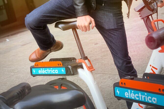
Since bicycles are not included, your default mode is walking. If you prefer cycling, you can rent an eBike through the RideMovie application (paid separately). That’s good to know up front because it changes how you’ll experience the route: walking gives you better street-level reading; biking can shorten distances.
Finally, this runs as a private tour/activity, meaning only your group participates. That typically makes questions more comfortable, especially if you’re curious about how the planning system actually works.
Stop 1: Rambla del Raval and the Old-Town Context
Your first stop is Rambla del Raval, a part of Ciutat Vella where the city’s historic situation shows up clearly. This is where the tour lays the groundwork. You’re not thrown straight into modern experiments. You get the background for why the city needed to change in the first place.
Raval is often described through its character and energy, but on this tour the angle is different. You’re aiming your attention at street structure: how old urban patterns shape what’s possible today. When a guide connects historic layout to modern mobility goals, it stops being an art-history story and becomes a city-making story.
What I like about starting here is that it keeps the rest of the tour honest. When you later hear about traffic reduction, superblocks, and innovation districts, you’re not starting from a blank page. You’re starting with a real city that already has constraints and history baked into it.
Possible consideration: because this is a walking tour that begins in older streets, wear shoes that handle uneven pavement and lots of turns.
Stop 2: Sant Antoni and the Superblock Concept You Can See

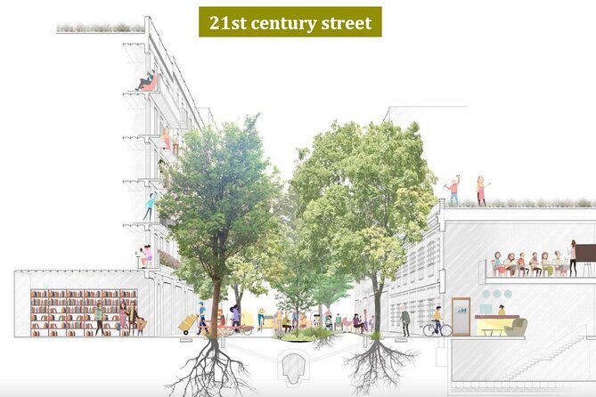
Next you move to Sant Antoni, where the star idea is the superblock. This is one of those planning terms that can sound like jargon until you’re standing near it. The guide’s job here is to show you what a superblock actually changes in daily life.
A superblock is about reorganizing traffic and public space so neighborhoods feel more human and less car-dominated. In plain terms: it’s a way to reduce through-traffic and make streets friendlier for walking and community life.
This stop is short, about 15 minutes, but you don’t want that to mislead you. Short stops can be strong when the guide focuses your attention. I’d treat this as your moment to ask yourself: What would this street feel like if the driving routes changed? That’s the mindset that makes the later Eixample and Glòries stops click.
Potential drawback: superblocks vary in how they feel depending on the exact street corner and time of day. So if you’re very sensitive to noise or crowds, you may want to arrive ready to read the neighborhood in motion, not in perfect museum quiet.
Stop 3: Eixample and Consell de Cent’s Reduced-Traffic Axis
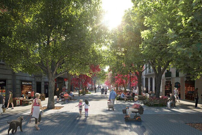
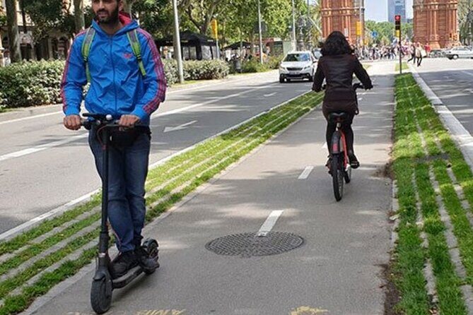
Then comes Eixample, and specifically the Consell de Cent street, described as a newly traffic reduced/free axis running through Barcelona. This is where you’ll see how Barcelona applies mobility changes in a more grid-like, structured part of the city.
Eixample is the kind of neighborhood where street design choices feel obvious. You can better visualize routes, crossings, and how the street hierarchy changes when certain corridors prioritize pedestrians or restrict car movement.
This stop runs about 30 minutes, which gives you time not just to walk through, but to absorb what the guide is pointing out. The most valuable part of an explanation here is learning how planners think about trade-offs: routing vehicles differently, shifting pressure to other streets, and designing public space so it’s usable—not just closed.
If you come into this tour expecting big flashy attractions, Eixample might surprise you in a good way. It’s a working example of city policy showing up in public space.
One watch-out: because traffic patterns change, you may find streets that feel calmer than you expect and routes that feel different from what Google Maps suggests. Let the guide’s route set the pace.




Stop 4: Glòries (22@) and the Innovation District Shift
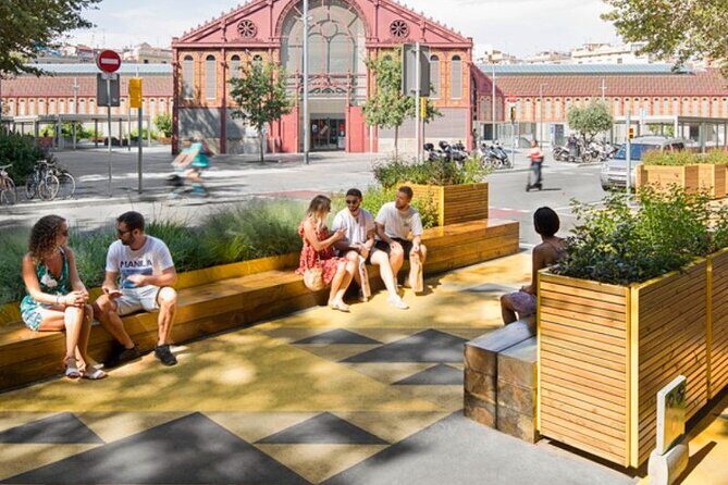
Your final stop is Glòries, in the 22@ district, the former industrial area now framed as an Innovation District. This is a key contrast to the superblocks and the mobility-focused parts of the tour.
Here, the theme shifts from street design to future-looking planning. The city’s question becomes: what do we do with old industrial space, and how do we attract new kinds of activity without destroying the neighborhood’s livability?
This stop is about 30 minutes, and it matters because it broadens what you think smart-city means. Smart-city usually sounds like sensors, apps, and tech. On this tour, it’s more about planning direction—how economic and social goals show up in zoning decisions and district redevelopment.
It’s also the kind of ending that makes you look at the city differently when you walk away. Once you’ve seen how Barcelona is thinking about mobility and using districts for new economic identity, you’ll probably start noticing planning signals everywhere—construction zones, street priorities, and public-space investments.
What the Expert Guide Actually Adds
The tour includes an expert guide, and the guide is the difference between casual walking and real learning. Several guide experiences highlighted a strong focus on turning planning into something you can follow—what decisions were made, why, and what impact they aim for.
In past bookings, names like Onno and Yannis came up as friendly, considerate, and effective at making the topic feel readable. You can think of it like this: the guide gives your eyes a checklist. Instead of just seeing streets, you notice the design logic behind them.
Also, because it’s in English, you get the benefit of the explanation without needing to translate mentally. For a topic like sustainability and planning, that’s a big deal.
Price and Value: Is $210 Worth It?
At $210.28 per person, this tour is not a budget add-on. The value only makes sense if you’re interested in how cities work and you want an organized path through the ideas.
Here’s the practical way I think about it:
- You’re paying for a guided, expert-led explanation across multiple districts rather than one neighborhood photo walk.
- The route targets specific planning themes: superblocks, traffic reduction, and the 22@ innovation shift.
- It’s a private tour for your group, which can increase value if you’re traveling with people who want to ask questions.
What could affect the value for you is the choice about bikes. If you want to use an eBike, you’ll pay extra via the RideMovie app. That can change the total spend. If you’re happy to walk, you avoid that extra layer.
One more note: the tour is often booked fairly far in advance, averaging about 81 days ahead. That’s usually a sign that the time slots you want go first. If your dates are fixed, reserve early.
Who This Tour Suits Best (And Who Might Skip It)
This tour fits best if you like:
- city planning, architecture beyond the façade
- sustainability topics tied to real street changes
- learning how government decisions affect day-to-day life
- walking-focused sightseeing in a structured route
It may not be your best match if you want:
- classic major-monument focus only
- a mostly “look at this view” experience
- included bike time (since bikes are not included)
If you’re the kind of traveler who enjoys reading a city like a puzzle—why this street works, why this neighborhood changed—you’ll probably feel satisfied by the way the stops build on one another.
Smart-City Takeaways You’ll Carry Into the Rest of Your Trip
The best souvenir from this kind of tour isn’t a photo. It’s a mental map of cause and effect.
After walking through Rambla del Raval, Sant Antoni, Eixample, and Glòries, you’ll likely start spotting patterns:
- where car routes are being redirected
- how street space gets rebalanced
- how districts shift from older uses to newer agendas
And because Barcelona is a city of many layers, that skill travels. Even if you don’t visit another city on the same trip, you’ll still notice how public space choices shape your own comfort level while walking.
If you’re doing other Barcelona sights afterward, you’ll also have an easier time connecting them. A park, a plaza, a calmer street—these become outcomes of planning choices rather than random scenery.
Should You Book This Barcelona Urban Planning Tour?
I’d book it if you want a Barcelona tour that explains why the city looks and feels the way it does. The route is short, guided, and focused on real planning experiments—superblocks, traffic reduction, and 22@—so you come away with usable insights, not just stories.
I’d think twice if you’re mainly hunting for big visual icons or if walking for 2 to 4 hours is hard for you. Also, if you’re expecting a bike tour, note that cycling is optional, and eBike rental is separate via RideMovie.
If you fall in the first group—curious, street-level learners—this is a strong value purchase in the category of guided city thinking. Book ahead since it’s commonly reserved well before travel, and get ready to look at Barcelona with a planner’s eye.
FAQ
How long is the Barcelona Urban Planning Tour?
The tour runs about 2 to 4 hours.
What’s the price per person?
The price is $210.28 per person.
Is the tour in English?
Yes, it’s offered in English.
Where do we meet and where does the tour end?
You start at El Gato de Botero on Rambla del Raval, and the tour ends at El Parc i la Llacuna del Poblenou in Sant Martí.
Is a bicycle or eBike included?
Bicycles are not included. If you want an eBike, you rent it and pay through the RideMovie application.
What’s the cancellation policy?
You can cancel for a full refund up to 24 hours before the experience’s start time.